

Voyage Overview
Sail through the storied heart of the Arctic on an expedition that weaves history, landscape, and living culture into one extraordinary journey.
Travel westward through the Northwest Passage beneath the long light of late Arctic summer. From Greenland’s glacier-carved coast to the sweeping tundra of the western Arctic, journey through Inuit Nunangat, where land, water, and ice sustain communities and iconic wildlife. Following the east-to-west course sought by generations of explorers, Inuit educators and expert guides illuminate the Passage’s layered history and ecosystems supporting seabirds, marine mammals, and tundra wildlife. This is one of the world’s great maritime journeys.
Trip Details

Duration: 17 Days

Ship: Ocean Victory, Premium Ship, 186 Guests

Start: Toronto, ON, Canada
End: Yellowknife, NT, Canada
Highlights:
- 5 planned days in West Greenland & 9 days in the Canadian Arctic / Northwest Passage
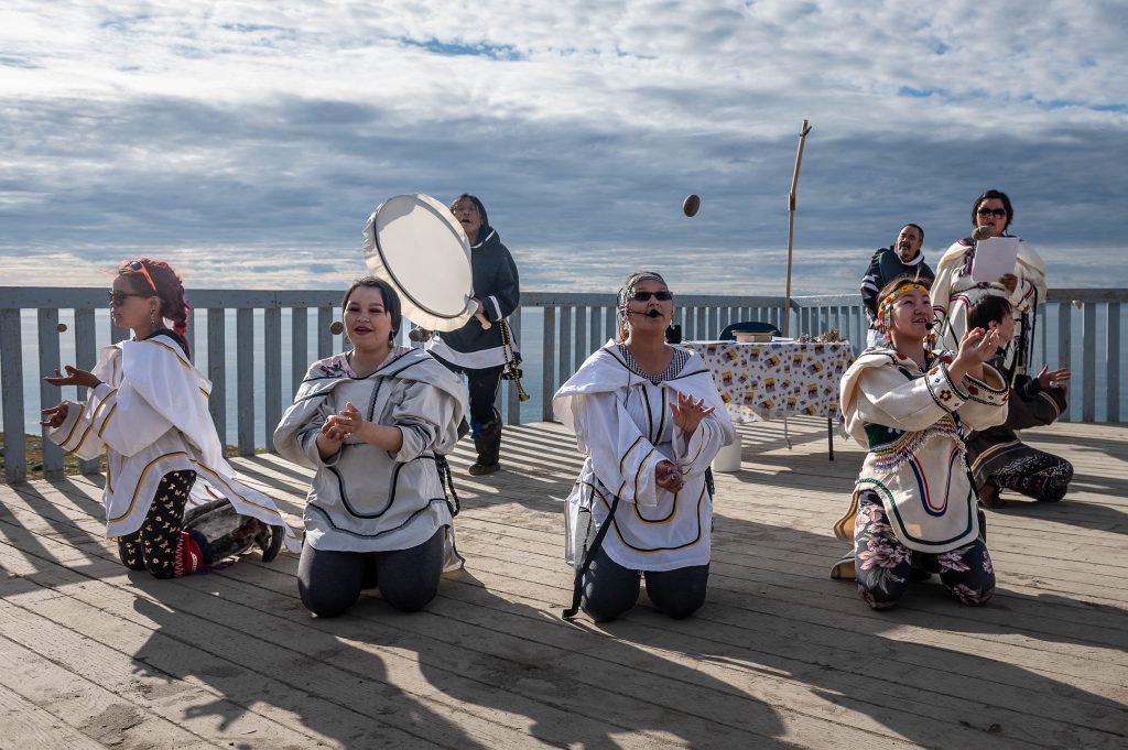
- Journey through Inuit Nunangat with Inuit who share knowledge, stories, and perspectives rooted in the places through which we travel
- Marvel at enormous icebergs at Ilulissat Icefjord, a UNESCO World Heritage Site
- Step into the Franklin mystery at Beechey Island, where graves and expedition remains connect its windswept shoreline to one of exploration’s most enduring stories
- Search for the wildlife of Tallurutiup Imanga, an exceptionally rich marine ecosystem supporting whales, walrus, seals, polar bears, and seabirds
- Retrace the historic route of European explorers, who for centuries picked their way through ice in hopes of finding a sailing route through the passage
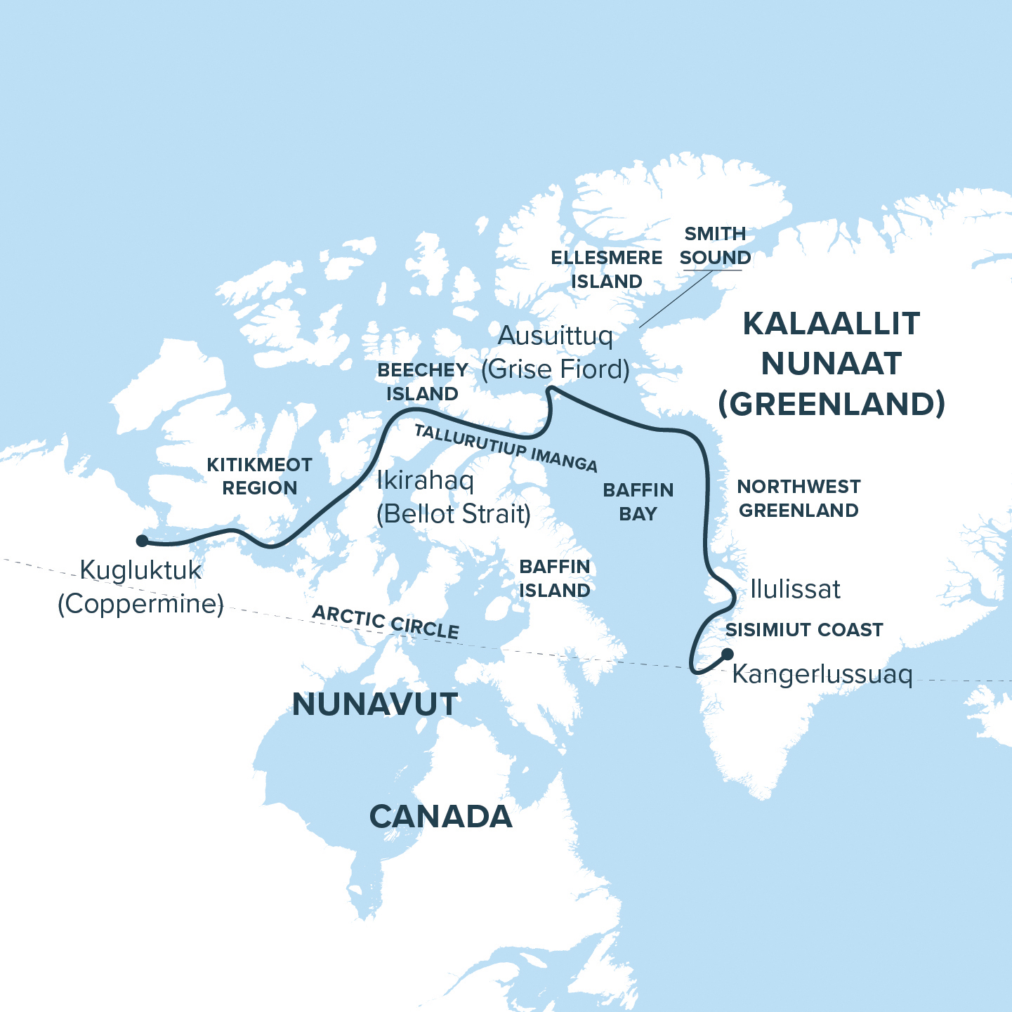
Trip Itinerary Overview:
Day 1: Charter flight from Toronto to Kangerlussuaq, Greenland & Embarkation
Day 2-3: Sisimiut Coast
Day 4: Ilulissat
Day 5-6: Northwest Greenland
Day 7: At Sea
Day 8: Smith Sound
Day 9: Ausuittuq (Grise Fiord), NU, Canada
Day 10-11: Tallurutiup Imanga (Lancaster Sound) and Devon Island
Day 12: Beechey Island
Day 13: Ikirahaq (Bellot Strait)
Day 14-16: Kitikmeot Region
Day 17: Disembark in Kugluktuk (Coppermine), NU, Canada & Charter Flight to Yellowknife


Tour Dates
- April 2028 to September 2028
| Dates | Availability | |
|---|---|---|
Aug 17 – Sep 2, 2028 (17 days) | Available | view pricing chart |
Itinerary
Day 1: Charter flight from Toronto to Kangerlussuaq, Greenland & Embarkation
This morning, take a charter flight from Toronto to Kangerlussuaq, Greenland. Kangerlussuaq lies within a broad glacial valley between the Greenland Ice Sheet and the sea. Its dry climate and unusually stable weather led to the establishment of an American air base here during the Second World War and continue to make it one of Greenland’s most important aviation gateways. The surrounding region has a much longer history as a place of Inuit travel and hunting. Upon arrival, board the expedition vessel and begin the long passage through Kangerlussuaq Fjord. Mountains, glacial valleys, and pale meltwater mark the transition from Greenland’s interior to its western coast. Crossing the Arctic Circle, the route opens towards the long light and expansive waters of late Arctic summer. *Note all guests should arrive into Toronto at least one day prior to Day 1 (hotel nights not included in voyage cost).
Day 2-3: Sisimuit Coast
Greenland’s west coast unfolds as a complex meeting of islands, mountains, sheltered waterways, and deep fjords. Late summer brings color to the tundra, with Arctic cotton, crowberry, dwarf birch, and willow spreading across slopes beneath dark rock. Seabirds are active along the coast, while whales may be encountered in the waters offshore. Human history here reaches back more than 4,500 years. Archaeological traces left by successive cultures, including Saqqaq, Dorset, and Thule peoples, speak to generations of movement and adaptation along this coast. Zodiac cruises, hikes, and time ashore offer different ways to encounter a landscape where the sea has long connected hunting grounds, settlements, and travel routes.
Day 4: Ilulissat
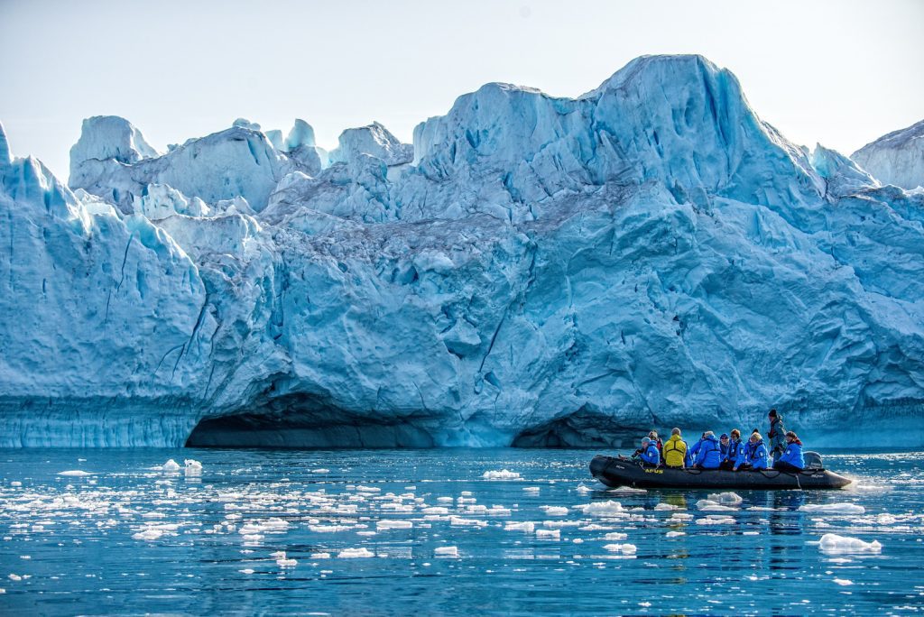
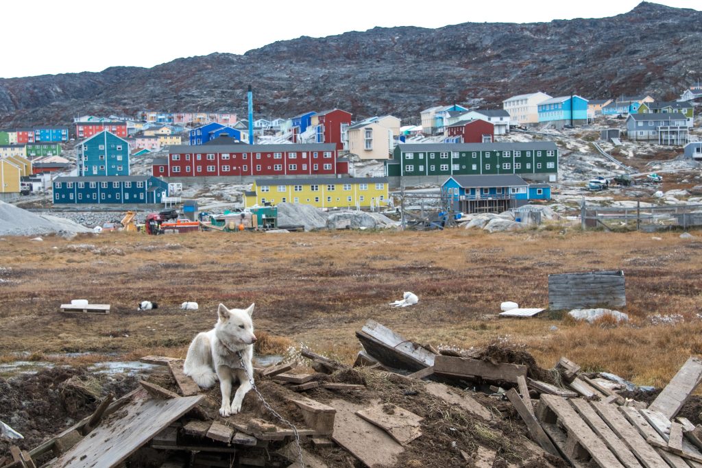
At Ilulissat Icefjord, a UNESCO World Heritage Site, the world distills to ice and light. The vast Sermeq Kujalleq glacier sends its creations—crystalline cathedrals of blue and white—into Disko Bay, where they drift, groan, and fracture. Ilulissat means “iceberg,” and here the name feels earned. Walk the boardwalk above the fjord as thunder echoes from the ice below. Visit the Icefjord Centre to trace the stories held within this landscape: scientific, cultural, and deeply human. In town, wander through museums, cafés, and craft shops alive with colour and conversation—a vibrant contrast to the hushed immensity of the ice itself.
Day 5-6: Northwest Greenland
Northwest Greenland is a far-reaching world of islands, narrow channels, sheltered bays, and deep fjords enclosed by steep mountains. Glaciers descend from the ice sheet, while the West Greenland Current carries immense icebergs north along the coast. Many began their journeys in Disko Bay, joining bergs released by glaciers farther north to form a great moving flotilla of towers, arches, and fractured blue faces. Small communities occupy rocky islands and natural harbours throughout this intricate seascape. Fishing and hunting remain central to life, while boats connect settlements separated by water and rugged terrain. Explore the coast by ship, Zodiac, and on foot, following shorelines alive with seabirds and walking across tundra brightened by Arctic cotton, crowberry, and late-summer wildflowers. Long hours of daylight reveal a landscape of immense scale, where every channel offers a different arrangement of rock, water, and drifting ice.
Day 7: At Sea
Baffin Bay extends between Greenland and the Canadian Arctic, carrying currents, wildlife, and immense drifting ice between its coasts. Icebergs moving north along Greenland may turn west through these waters before joining the southbound current along Baffin Island. Whales, seals, northern fulmars, kittiwakes, murres, and dovekies also travel and feed across this vast marine ecosystem. A day aboard offers time to watch the bay unfold from the decks and observation spaces. Presentations, workshops, and conversations with Inuit cultural educators, naturalists, historians, and other expedition team members explore the wildlife, geography, cultures, and exploration history of the region. Ahead lies Smith Sound and the entrance to the waterways of the High Arctic.
Day 8: Smith Sound
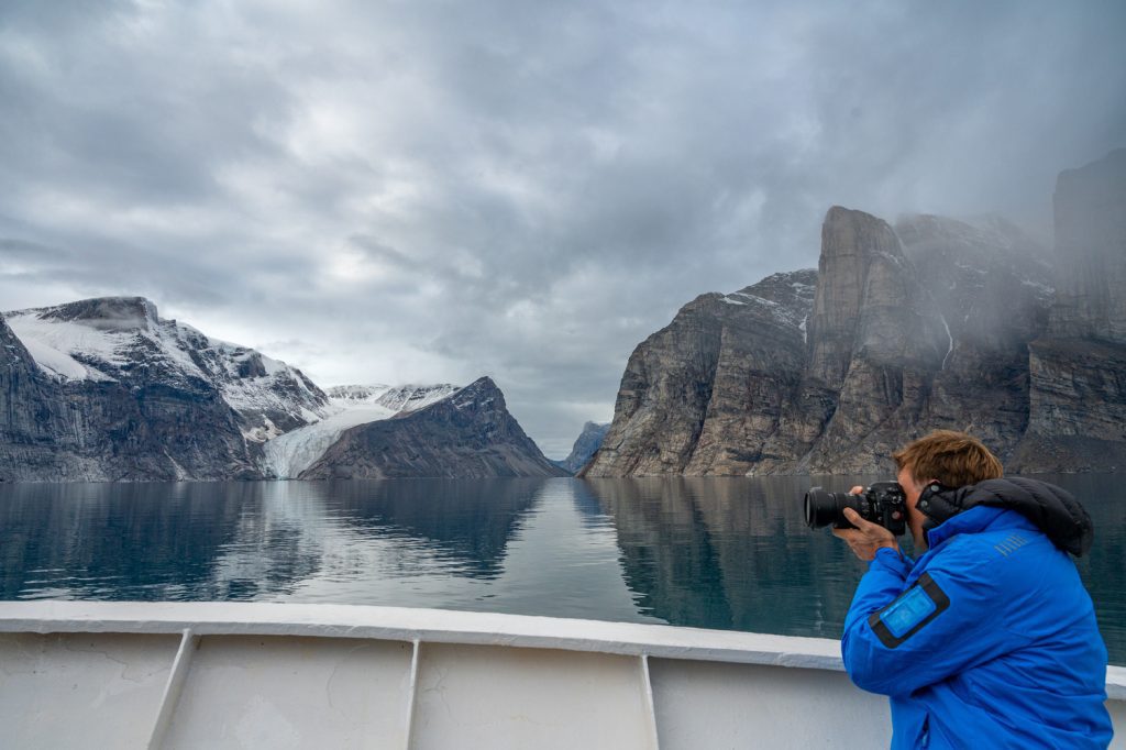
Smith Sound forms a dramatic channel between Greenland and Ellesmere Island. Mountains and glaciers rise on either side, while drifting ice moves through waters connecting Baffin Bay with the waterways farther north. The scale of the passage is heightened by the clear, extended light of late summer. Inuit have long travelled and hunted throughout this region. During the nineteenth century, Smith Sound also became a route for expeditions searching for Franklin and attempting to reach the North Pole. These histories meet within a landscape still governed by ice, currents, weather, and distance.
Day 9: Ausuittuq (Grise Fiord), NU, Canada
Set between the mountains and sea of southern Ellesmere Island, Ausuittuq means “the place that never thaws.” Canada’s northernmost civilian community occupies a landscape of glaciers, vast tundra, and waters that remain covered by sea ice through much of the year. The community was established in 1953 through the Canadian government’s relocation of Inuit families from Inukjuak and Mittimatalik. That difficult history remains an important part of Ausuittuq’s story, alongside more than seventy years of community life shaped by family, ingenuity, and cultural continuity. Hunting, travel on the nuna (land), artistic expression, and the rhythms of the seasons remain closely woven into life here. Time with local hosts offers a view of contemporary High Arctic community life within the immense landscape of Ellesmere Island.
Day 10-11: Tallurutiup Imanga (Lancaster Sound) and Devon Island
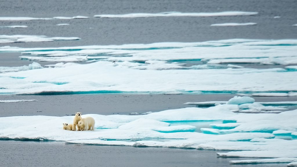
Tallurutiup Imanga is the ecological engine of the eastern Canadian Arctic. Nutrient-rich waters and recurring areas of open water support narwhal, beluga and bowhead whales, walrus, seals, polar bears, and some of the Canadian Arctic’s largest seabird colonies. In late summer, marine mammals continue to move through the channels while birds gather along cliffs and shorelines before migration. This National Marine Conservation Area is also an Inuit homeland used for travel, harvesting, and cultural practice for millennia. Inuit stewardship and Inuit Qaujimajatuqangit, or Inuit knowledge, play an essential role in its protection. Inuit expedition team members and naturalists bring the relationships among currents, ice, wildlife, and human life into focus. To the north, Devon Island rises in broad plateaus, glacial valleys, gravel plains, and open tundra. It is the world’s largest uninhabited island, although archaeological sites attest to centuries of Inuit and earlier human presence. Walks and Zodiac explorations reveal delicate late-summer vegetation, immense geological scale, and coastlines approached most naturally from the sea.
Day 12: Beechey Island
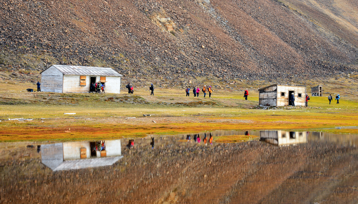
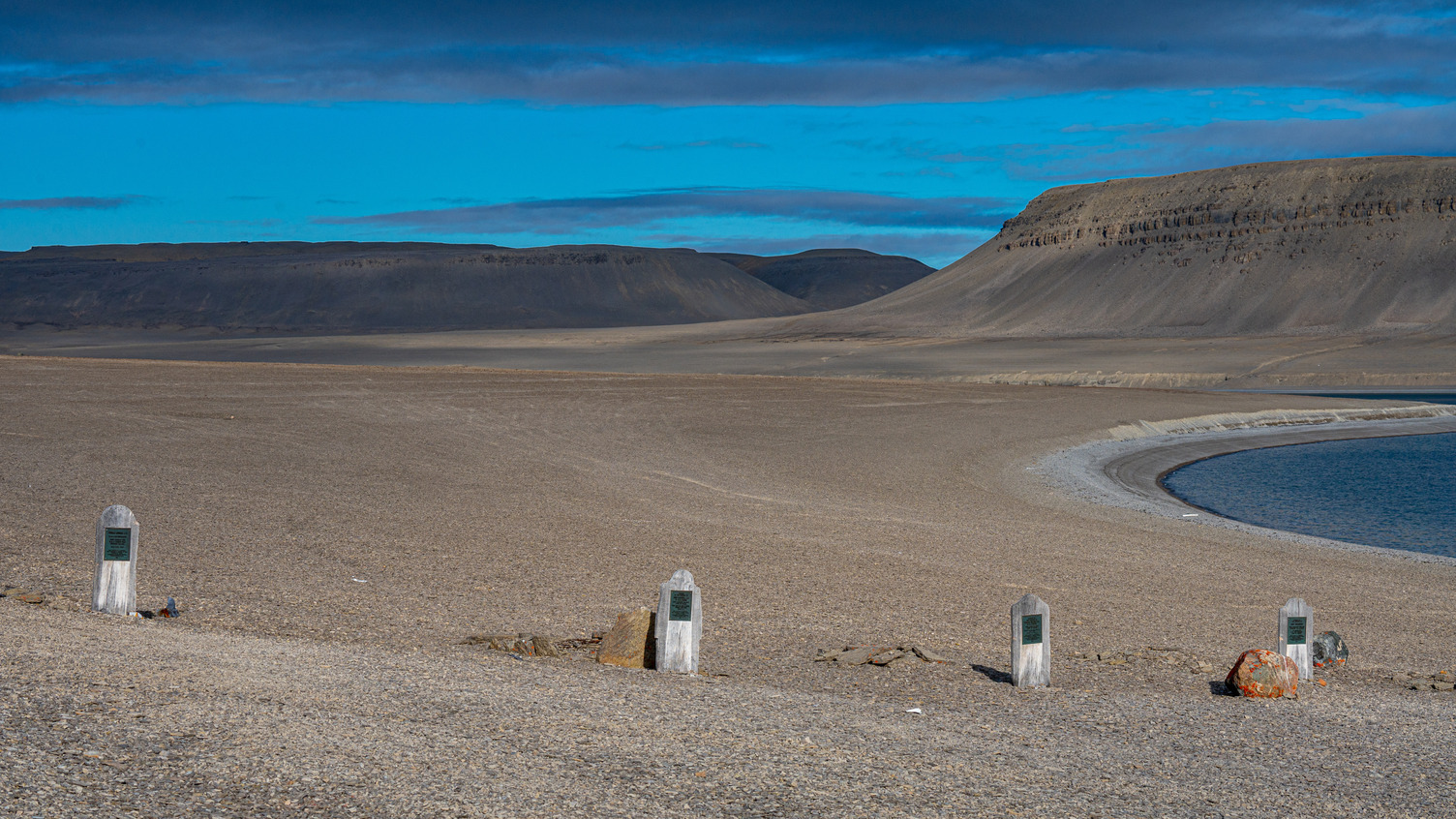
Beechey Island holds one of the most tangible chapters in the history of Northwest Passage exploration. Franklin’s expedition spent the winter of 1845–46 here before sailing onward and disappearing. Three graves, remains of the camp, and stone structures left by later search expeditions still mark its stark shoreline. Beechey became a gathering point for those who came north in search of Franklin, leaving supplies, messages, and traces of their own journeys. A fourth grave belongs to Thomas Morgan of HMS Investigator, who died during one of these searches. In the decades following Franklin’s disappearance, dozens of expeditions entered the Arctic, charting extensive areas and extending European scientific and imperial attention across Inuit Nunangat. Inuit testimony proved essential to tracing the expedition’s final movements and, generations later, locating its lost ships. Beechey Island connects Franklin’s failed voyage with its wider legacy, including expanded geographical knowledge, growing colonial ambitions, and an increasingly sustained southern presence in Inuit homelands.
Day 13: Ikirahaq (Bellot Strait)
Ikirahaq is a narrow, twenty-five-kilometre passage separating Somerset Island from the Boothia Peninsula. At its narrowest, little more than a kilometre divides the shores. Strong tidal currents move through the channel as the waters of the eastern and western Arctic meet. Granite walls rise close to the route, while seals, whales, seabirds, and occasionally polar bears may be seen along the shore or among the moving ice. On the southern side lies Murchison Promontory, the northernmost point of mainland North America. Ikirahaq has long been travelled by Inuit. It later became important to expeditions searching for Franklin and attempting to navigate the Northwest Passage. The English name honours French naval officer Joseph René Bellot, who joined two Franklin searches before his death in the Arctic in 1853. Passage through this confined and powerful waterway remains shaped by current, ice, weather, and careful navigation.
Days 14-16: Kitikmeot Region
Sail Through the Heart of the Northwest Passage. The Northwest Passage opens westward into the low tundra, scattered islands, and distant horizons of the Kitikmeot Region. Wide sounds narrow into channels that weave among gravel coastlines, wetlands, and archaeological sites. Muskoxen and caribou move across the land, seals and whales travel the surrounding waters, and migratory birds gather before beginning their journeys south. The western Kitikmeot is the homeland of Inuinnait, a distinct regional group of Inuit whose language, Inuinnaqtun, carries the place names, stories, and knowledge of this region. Generations of harvesting caribou, muskoxen, seals, and fish have shaped distinctive clothing, tools, food traditions, and patterns of travel. Today, Inuinnait communities are strengthening the transmission of their language and culture while sustaining close relationships with the land and sea. These waters also form part of the route navigated by Roald Amundsen during the first complete transit of the Northwest Passage. His success drew heavily upon skills learned from Netsilik Inuit while overwintering near present-day Uqsuqtuuq (Gjoa Haven) in the eastern Kitikmeot. Over three days, landings, tundra walks, Zodiac explorations, and time along the coast bring the wildlife, cultural depth, and open geography of the western Arctic into view.
Day 17: Disembark in Kugluktuk (Coppermine), NU, Canada & Charter Flight to Yellowknife, NT
Kugluktuk stands where the Coppermine River enters Coronation Gulf. Its Inuinnaqtun name means “place of moving waters,” reflecting the currents and rapids that have long defined this meeting of river, tundra, and sea. The Coppermine has supported travel, fishing, and life on the land for generations. Today, Kugluktuk is a close-knit community known for its artists, strong connections to the surrounding country, and position at the western edge of Nunavut. Here, the east-to-west passage reaches its conclusion at the mouth of one of the Arctic’s great rivers. After disembarkation, a charter flight carries guests to Yellowknife, completing the journey from Greenland’s glacier-carved coast across the waterways of Inuit Nunangat.
Published itineraries reflect our intended route and experiences but cannot be guaranteed. Weather, sea and ice conditions, government regulations, operational considerations, wildlife, and other circumstances may require changes to the planned schedule. Visits to specific communities also depend on local conditions and the needs, availability, and requests of the communities themselves. When changes are necessary, we will seek the best available alternatives, including another community visit where circumstances allow.
Trips & Rates
Please note, rates are Per Person in USD
Availability & prices are subject to change at anytime
Aug 17 – Sep 2, 2028 (17 days)

| Start: | Toronto, ON, Canada |
| End: | Yellowknife, NT, Canada |

Charter Flights $2,850/person
Charter Flights between Toronto & Kangerlussuaq on Day 1 and Kugluktuk (Coppermine) & Yellowknife on Day 17. Not included in displayed pricing.
| Cabin Category | Triple Cabin | Albatros Cabin | French Balcony Cabin | Balcony Cabin | Superior Balcony Cabin | Grand Balcony Cabin | Balcony Suite | Junior Suite | Premium Suite | Solo Cabin | Solo French Balcony Cabin |
|---|---|---|---|---|---|---|---|---|---|---|---|
| Per Person Price in USD | $18,995 | $22,495 | $23,995 | $25,295 | $26,195 | $27,695 | $29,195 | $31,095 | $35,095 | $35,195 | $37,495 |
| Discount | Save 25% | Save 25% | Save 25% | Save 25% | Save 25% | Save 25% | Save 25% | Save 25% | Save 25% | Save 25% | Save 25% |
| Discounted Per Person Price | $14,246 | $16,871 | $17,996 | $18,971 | $19,646 | $20,771 | $21,896 | $23,321 | $26,321 | $26,396 | $28,121 |
| Availability | Open | Open | Limited | Open | Open | Open | Limited | Open | Full | Open | Limited |
Adventure Options:

Voyage Ship
Ocean Victory – AC
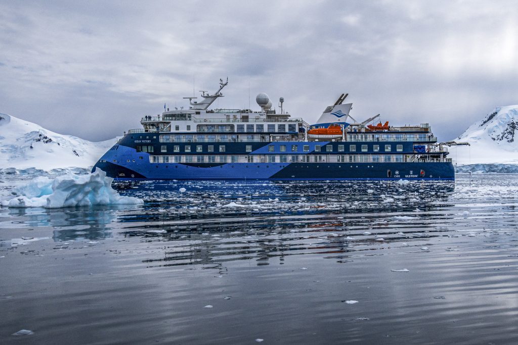
Ocean Victory is a stylish expedition ship launched in late 2021. The ship features 93 cabins, all with ocean view and 90% with a private balcony. Its X-Bow® design helps provide more stability when sailing in the open ocean and the 1A ice class is one of the highest among passenger ships.
Ocean Victory – AC Cabins & Deck Plan
Premium Suite
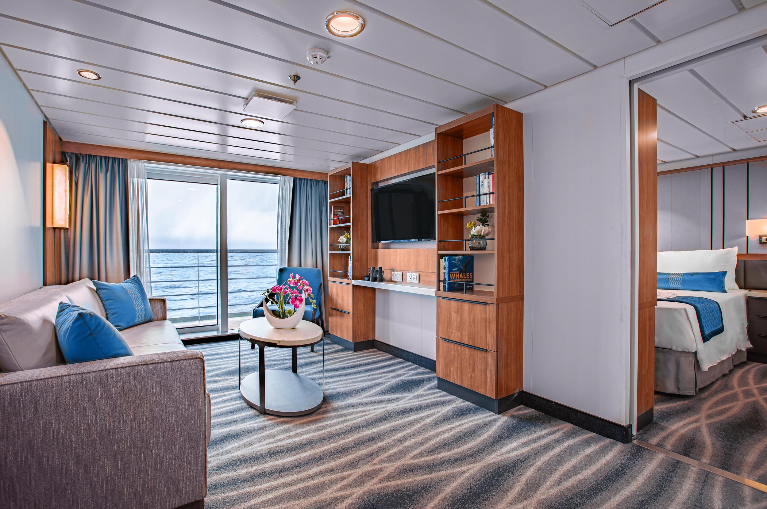
This 2-bedroom suite features a double bed (or twin beds), sitting area sofa bed, desk and chair, a balcony and a spacious bathroom.

452 ft² / 42 m² including balcony

1-4

1 double or 2 twin and sofa bed
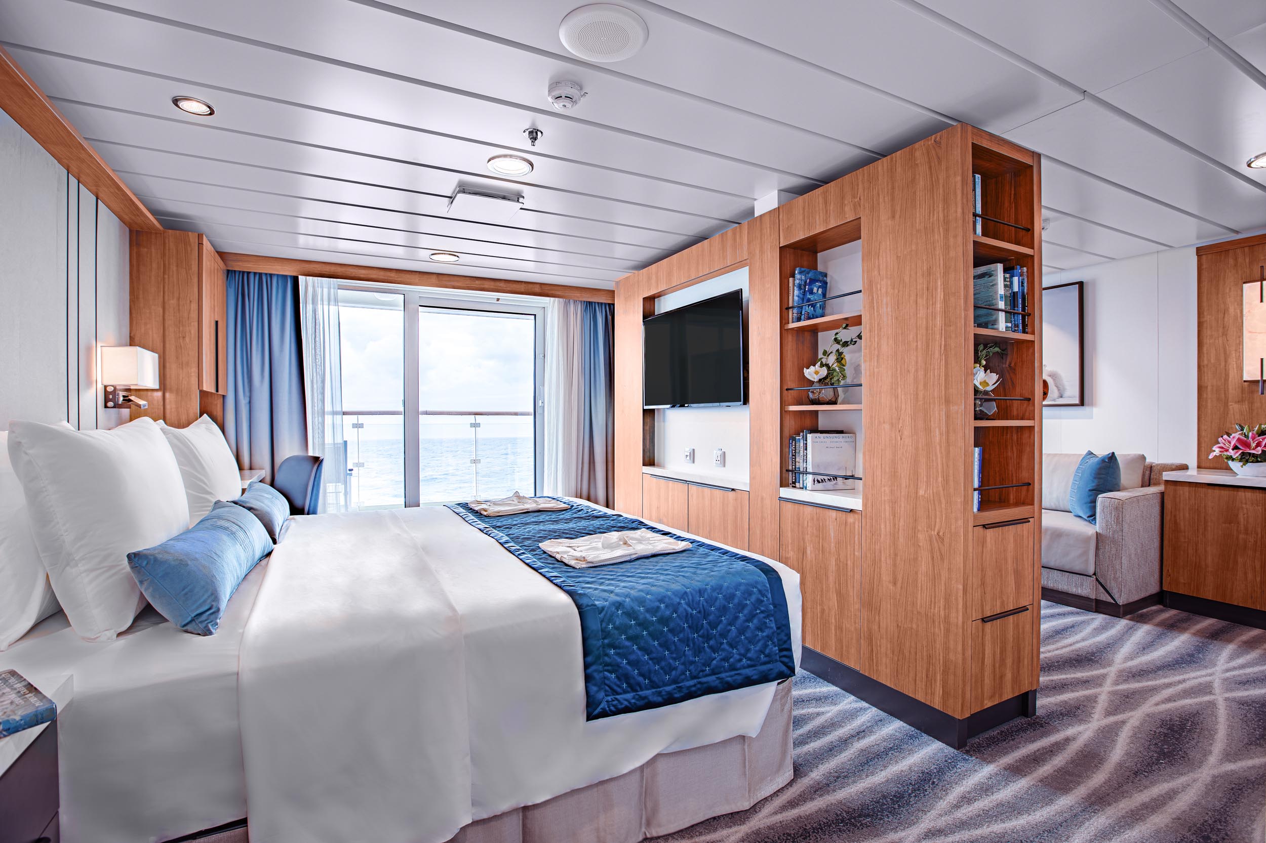
Junior Suite
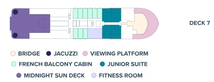
Deck 7
The 4 junior suites have a great view from their location high up on the ship. The suites feature a double bed or twin beds, sitting area with sofa bed, a spacious bathroom and a private balcony. The suite can accommodate up to 3 people.
388 ft² / 36 m² including balcony
1-3
1 double or 2 twin and sofa bed
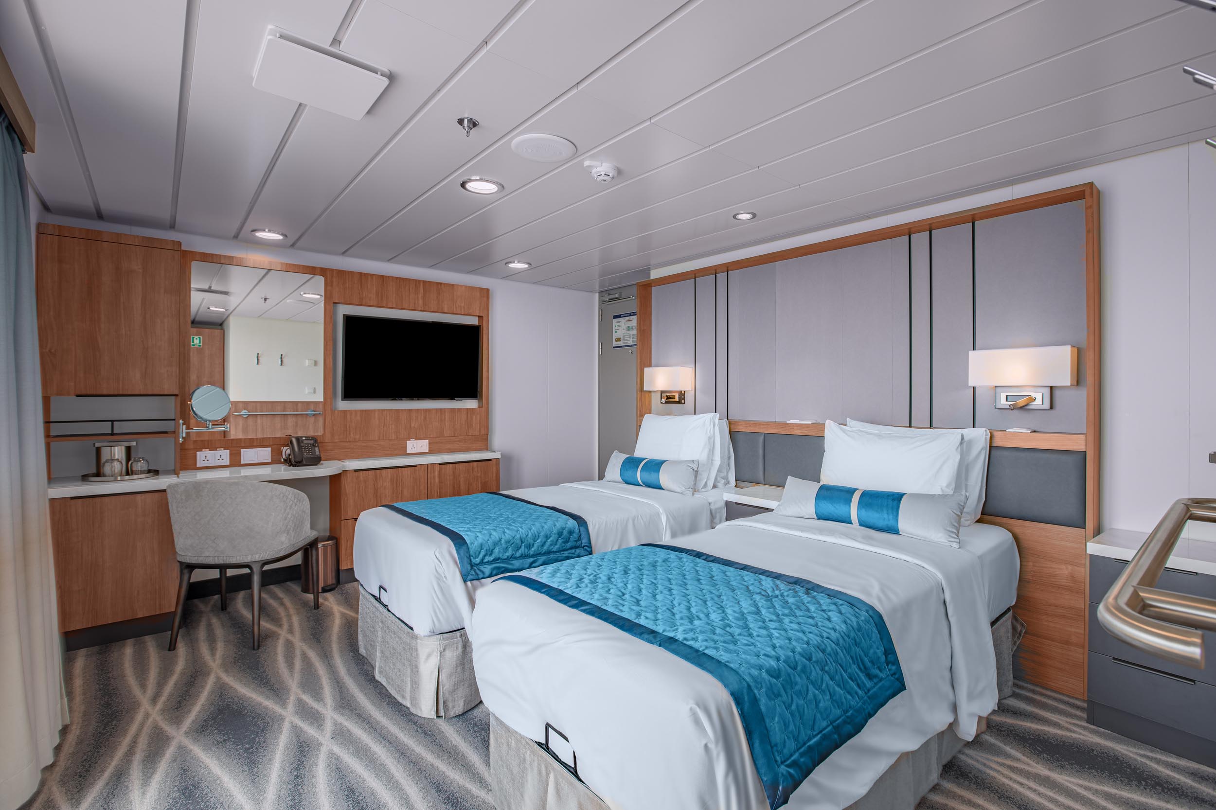
Balcony Suite
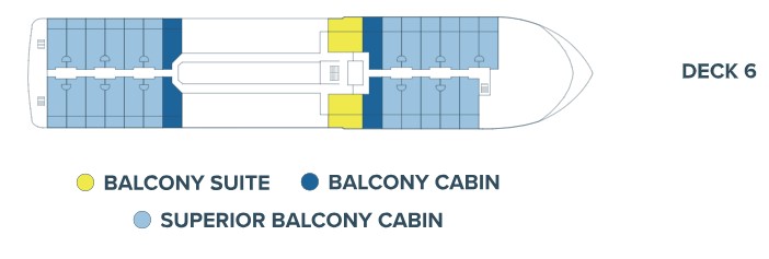
Deck 6
Ocean Victory has 2 Balcony Suites on board located mid-ship on deck 6. The suites feature double or twin beds, desk and chair, bathroom, and a large balcony.
280 – 344 ft² / 26 – 32 m² including balcony
1-2
1 double or 2 twin
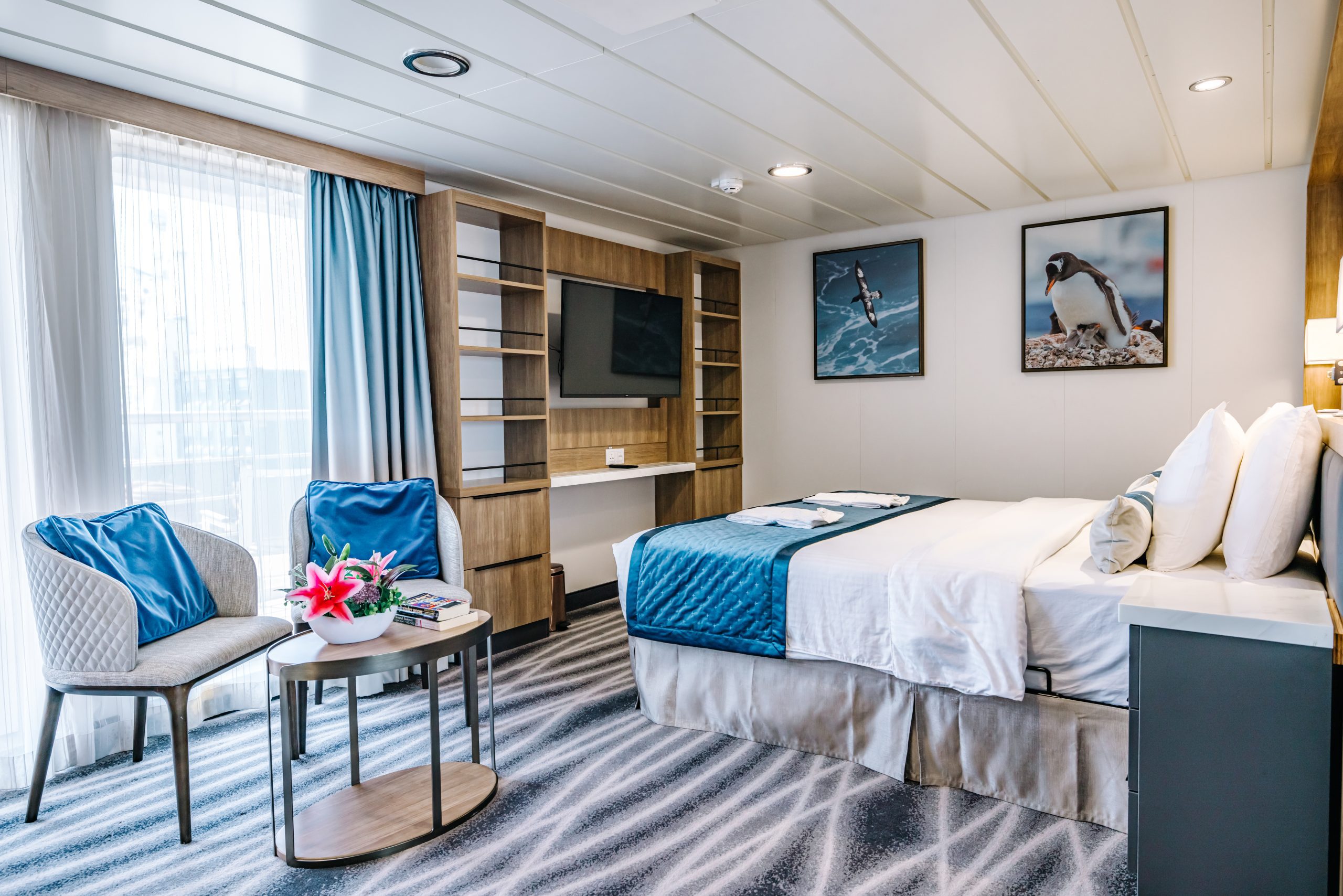
Grand Balcony Cabin
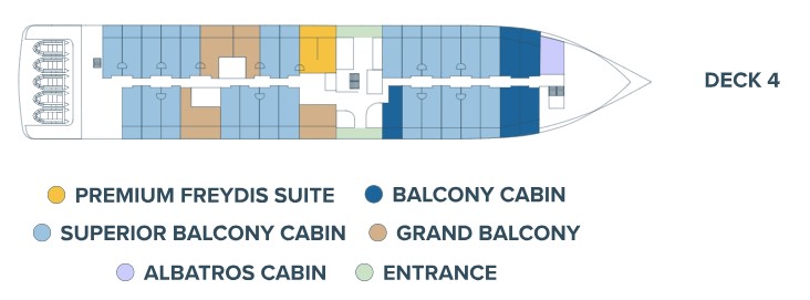
Deck 4
The Grand Balcony Staterooms are located on deck 4. They have a balcony, a double bed or two single beds, and a bathroom.
269 – 323 ft² / 25 – 30 m² including balcony
1-2
1 double or 2 single
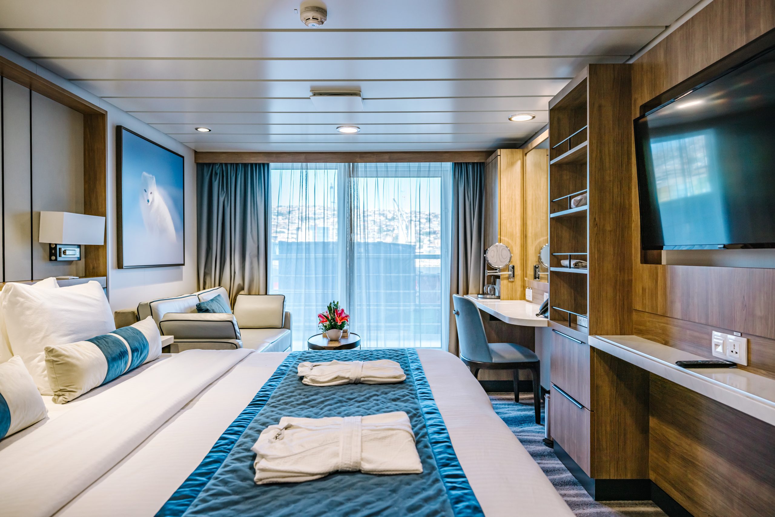
The most abundant cabin category on Ocean Victory, located on decks 4 & 6. They have a balcony, a double bed or two twin beds and a bathroom. The Superior Balcony Staterooms also include a seating area complete with a sofa, table and chair.
237 – 269 ft² / 22 – 25 m² including balcony
1-2
1 double or 2 single
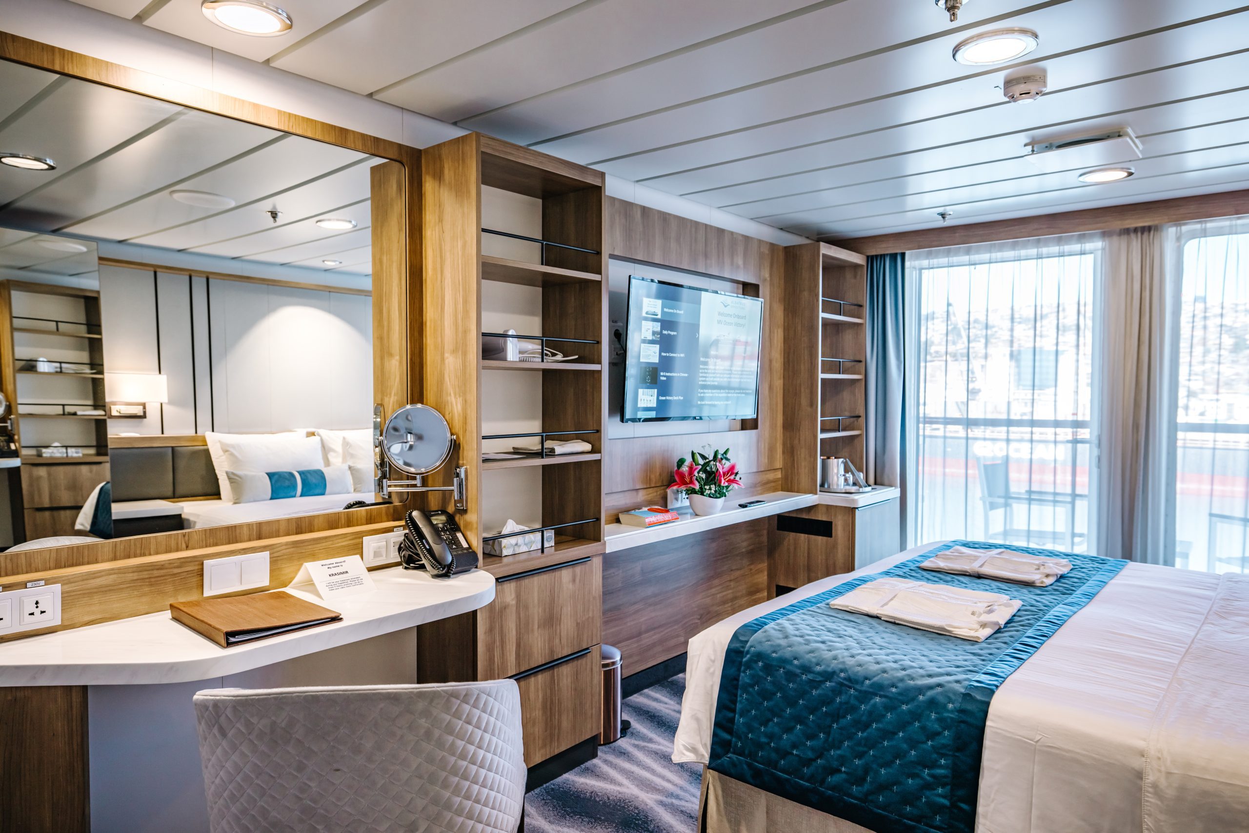

French Balcony Cabin
Deck 7
A standard stateroom with a French balcony, one queen-sized bed, floor-to-ceiling windows, desk and chair, and a bathroom.
151 ft² / 14 m²
1-2
1 queen


Triple Cabin
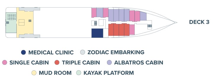
Deck 3
There are two Triple Staterooms on board Ocean Victory featuring portholes, desk and chair, and bathrooms.
194 – 237 ft² / 18 – 22 m²
3
3 single or 1 double plus sofa bed
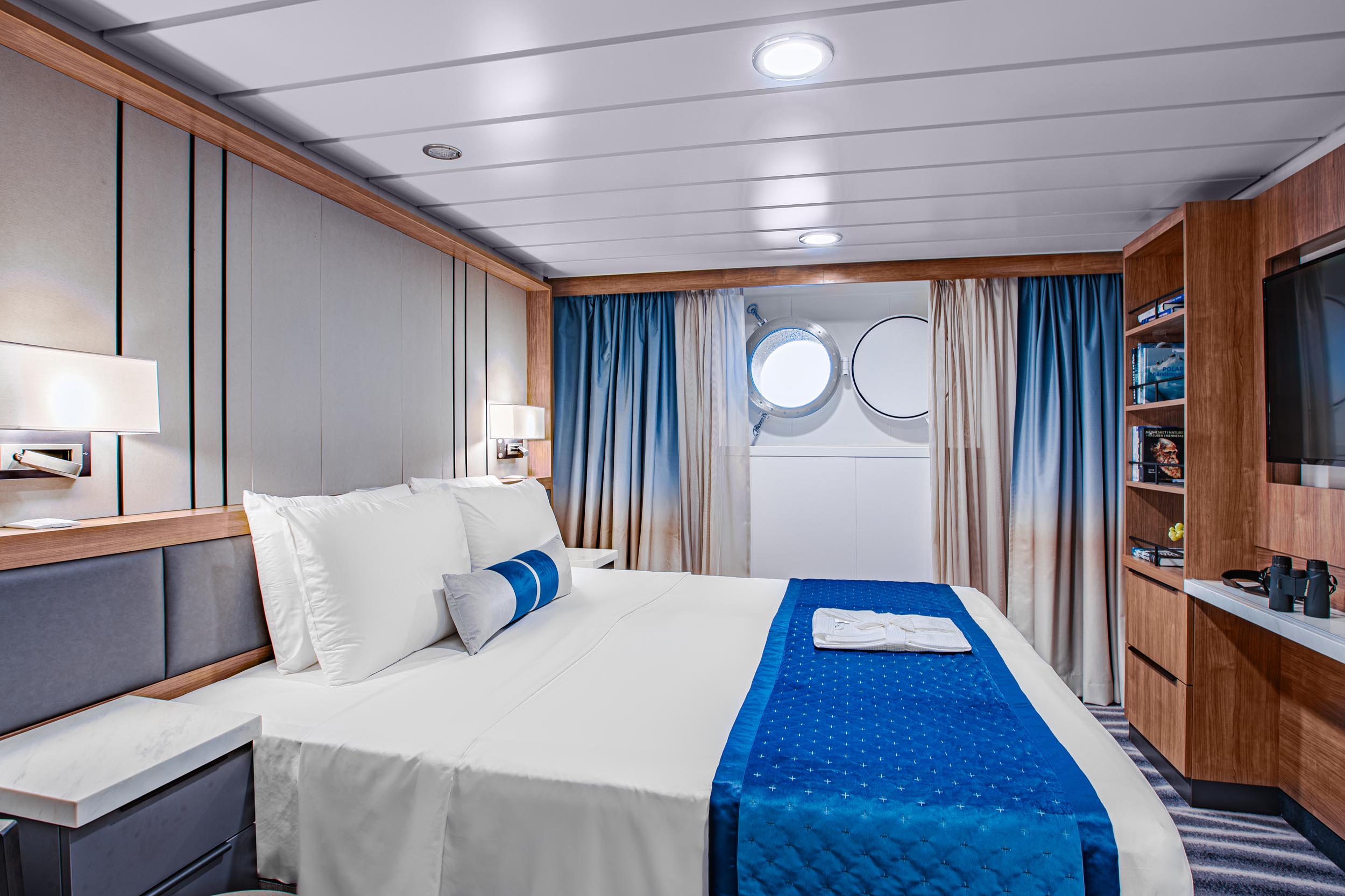
Solo Cabin
Deck 3
Standard single stateroom located on deck 3 with a porthole, desk and chair, and bathroom.
151 ft² / 14 m²
1
1 double
Solo French Balcony Cabin

Deck 7
A standard stateroom with a French balcony, one queen-sized bed (150×200 cm), floor-to-ceiling windows, and a bathroom.
151 ft² / 14 m²
1
1 queen
Inclusions/Exclusions
Inclusions:
- Passage aboard the Ocean Victory
- Applicable taxes and credit card fees
- Complimentary expedition jacket
- Special access permits, entry, and park fees
- Expert expedition team
- Guided activities
- Sightseeing and community visits
- All Zodiac excursions
- Port fees
- Pre-departure materials
- Educational program
- Interactive workshops
- Evening entertainment
- All shipboard meals
- Complimentary wine, beer, and soft drinks are served with dinner
- 1 GB complimentary Wi-Fi access (basic service included)
Exclusions:
- Commercial and charter flights
- Program enhancements/optional excursions
- Gratuities
- Personal expenses
- Mandatory medical evacuation insurance
- Additional expenses in the event of delays or itinerary changes
- Possible fuel surcharges and administrative fees
- Pre- and post-trip hotel accommodation
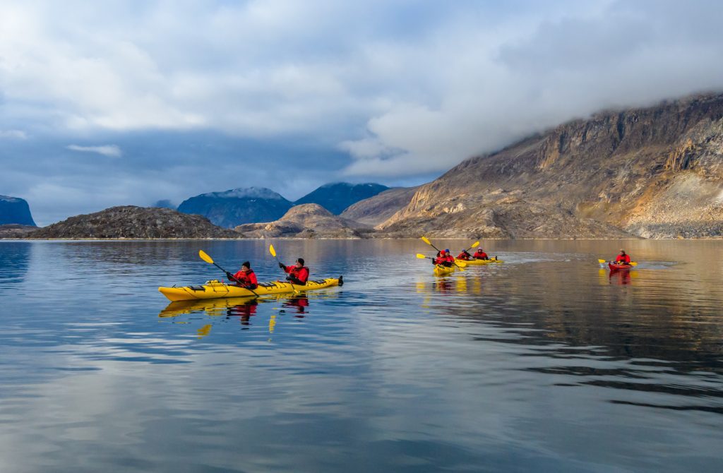
- Kayak program
- Premium Wi-Fi access
Solo Travelers
Are you traveling alone? Solo travelers have the following options:
- Can book a dedicated Solo Cabin or Solo French Balcony Cabin at prices listed above
- Can book into a share cabin
- Twin cabins can be booked at single occupancy at 1.7x the per person price in Albatros Cabin – Grand Balcony Cabins and 2x the per person share price for all higher categories

